Prologue:
A skull discovered on December 10th, 1931 sparked unsurpassed controversy during the great depression. That skull was of none other than Adolph Ruth. Ruth had entered the Superstition Mountain range, camping at Willow Springs, on June 14th, 1931, his quest being that of hidden treasure. He carried with him a map and directions to the mine, cave, or cache. He never left those mountains. A search for his body commenced when he failed to return two weeks after having been escorted to his camp site. In December of that year, an expedition headed by the Arizona Republic newspaper discovered Ruth’s skull some 6 miles from his camp site. Tex Barkley, a local rancher whose cattle grazed the range, stated that Ruth had not been in his camp for more than 24 hours. The rest of his remains were found three quarters of a mile away from his skull in January of 1932. Adolph Ruth’s map was not found on his person, but his pistol was still fully loaded. The map would be found at a later date.

Logging into my web mail server I notice some new messages, one from my friend Greg Davis. He only sends e-mails when it is something important, so I was a little excited to see what he has to say this time. It read as follows:
“Randy; I am thinking of trying to hike to Willow Springs in West Boulder Canyon this Saturday. Would you like to go along? If so we will have to leave the First Water Trail Head at first light. Greg”
Would I?!! Of course I would, I’d be a fool not to. You see, we are going to be hiking in the exact path that Jack Keenan and Leroy Purnell used to guide Ruth to his final camp destination. For me, following in the footsteps of one of the most historically significant treks into that “Thunder God” governed mountain range is almost a spiritual experience. It is something you have to experience for yourself as words can not describe the sensations felt, the thoughts running through one’s mind, and the overall joy of it all. I can say without a doubt it is an honor.
I awoke that morning, getting dressed for the day while warming up with a couple cups of coffee. I always get my pack in order the night before, checking all my supplies, water quantity, and emergency provisions to make sure I don’t forget anything the morning of the hike. You live, you learn, and that mountain range is absurdly unforgiving. I woke the wife around 5:30 AM so she can deliver me to the rendezvous point. Greg had not arrived yet, so I waited, thinking how early it is and how lazy I’ve gotten over the years.
Greg arrives shortly, then we hop into his vehicle of choice after a short pit stop, and off we went. Traveling up Hwy 88 before sunrise I can almost feel the presence of the Thunder God. It’s an odd, quite creepy feeling, like something is warning you to stay away. Something is telling me to go home, that I don’t belong here. The small, dim beady headlights on the 2 lane road contribute to the emotion. Of course I just brush it off, I’m just being silly. We pull into the trail head and park. First light has crept over the terrain, giving us a small glimpse of the nightmare through which we are about to hike.
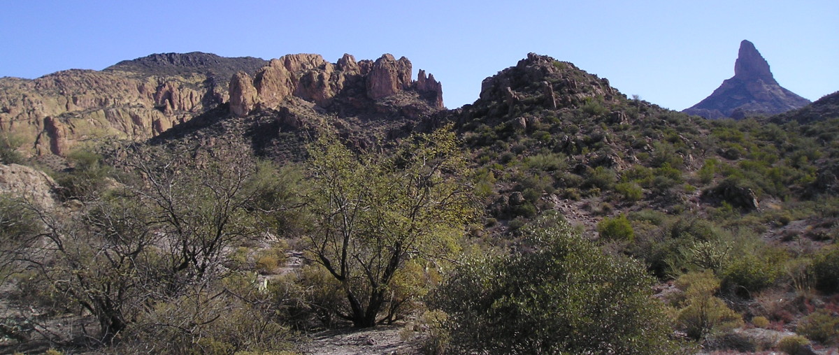
It’s a well worn path from the First Water trailhead to Parker Pass. This place is one of the most used trailheads in the entire Superstition Wilderness. Thousands of hikers and campers, young and old, large and small alike, scurry into the inner sanctum of the mountains every year from this very location. The evidence is presented before you like a slap in the face as the ground is beaten into a smooth, wide trail, year after year. This morning we join the many, taking a right at the split, heading South East towards Parker Pass to visit a place that only a handful will see during any given year. You see, West Boulder Canyon is a sparsely traveled canyon, and soon we will find out why.
Adolph Ruth was an old treasure hunter. Like many treasure hunters, he was easily excitable. Unlike most treasure hunters, Ruth was trusting, open and kind, almost to a fault. Understandably treasure and lost mine hunters are a funny bunch. One mention of a secret map, or hidden clues to anything, can land you full of lead, sniffing dirt, 40 miles from the nearest human. Just the whisper seems to bring all hell down on you, like raining bombs from the US Military. For some reason Adolph in all his years never learned this or he just never cared. He had found treasure before arriving in Arizona. He was experienced in finding lost mines utilizing maps as a guide; and one of these was responsible for the plate in his hip. This time Adolph Ruth hunted something far greater than he had ever hunted before. This time, it was one of the famous lost Peralta Mines. Ruth received maps and directions from his son, Erwin Ruth. Erwin was not a treasure hunter at all, and really didn’t approve of his fathers trampling the desert like a mad man in search of gold and other precious metals. You see, to Erwin it was just metals, nothing to fuss about. His father felt quite differently. He had the stars in his eyes. He was hooked, and nothing would stop him, not even 120 degree summer temperatures in one of the most rugged mountain terrains known to modern man. Adolph Ruth could not have picked a more desolate place to look for lost mines.
The Superstition Mountain range is very remote, very dry, and extremely rugged. The canyons are hundreds of feet deep with steep cliffs, razor sharp rocks; and death at every turn for the careless. Some of the most beautiful views will be afforded any man who dares risk his life to travel into this place. There is a vast range of animal life, including the smallest lizards to large bears and Mountain Lions. We must not forget the awe inspiring Saguaros that stand over you, shading you like a father who is hiding the sun from your pale skin.
It is in this terrain that Greg and I being our quest and search of the final camping place of Adolph Ruth. We are headed to one of the few year round springs know to exist in the entire mountain range. It is aptly named Willow Springs. We are traveling South East on a trail called “The Dutchman’s Trail”, named after the world famous Lost Dutchman. This trail winds from First Water Trailhead, through the mountains, to the Peralta Trailhead on the South side of the range. The Dutchman’s Trail is heavily traveled, probably the most traversed of all the trails in the Superstition Mountain Range.
We come through Transmission Gap, a small flat area filled with tall grass and a few mesquite trees. The place acquired its name from a vehicle someone abandoned on the North end of the “field”. At one point in time, a person could actually drive all the way to Parker Pass. Not anymore. We press on, making our way through the maze of canyons and boulders. There are some ups and downs, but overall the hike is relatively flat and uneventful to this point. On the East side of the Gap, you head down into a ravine and around the South end of it, then back up to what is called Parker Pass.
It’s a bit of a climb up to the Pass, but we won’t be going that far today. The turn off to West Boulder, our intended route, comes at the pass just before Parker Pass. I once knew the name of this pass, but today it escapes me. For now I will call it “Turn Off Pass”. Turn Off Pass is a great place to take a rest as you’re about 3 miles into the range. We sat down on some rocks and Greg pulls out his maps looking for the turn off point. Seems we’ve taken a rest at the right place, as this is where we head south into West Boulder Canyon. There is a small trail to follow, blink and you’ll miss it. Here I begin to think about Ruth, Purnell, and Keenan, all on horses or mules, turning off the beaten path, headed into dangerous territory, all in the name of finding lost treasure. I wonder what they talked about, what was said. I wonder if Ruth felt the heat at all, I wonder if Ruth contemplated that he had made a bad choice. At some point one would be inclined to believe that he has to say to himself; “What the hell am I doing?”

Looking towards Tim’s Saddle
As we came over a small saddle, I got the first glimpse of the journey ahead. To the left the sun glimmers from behind Weavers Needle as the morning shadows begin to fade, Greg said it was going to be a rough hike, but I never expected this. An arrow on the cactus points our way, and the trail is easily followed. Greg heads downhill first. Adolph Ruth wrote a letter to his family the night he arrived in camp. He described the trip into the spring, saying “we went up, down, up, down, then up and down again.” Tim’s Saddle is the 3rd up and down. It was just as Adolph had wrote, thus proving he was not spinning yarn, not this time.
Tex Barkley had repeatedly cautioned Ruth to stay at the ranch until he got back from conducting cattle business in town. The remoteness of the ranch meant Tex would be gone for some time. Business had to come first. Who would expect a rancher to put his financial gains on hold to haul some crazy treasure hunter into the mountains in the middle of summer, even if he had a map? Tex had to go, and so Ruth had to wait. Waiting was not Ruth’s forte, and sooner than later he found a pair of cow pokes to haul him into that place with the spring close to the “Needle”. This is where Ruth wanted to be. This was close to his maps destination. Ruth knew he would find this mine, as he had found the mine in Southern California that cost him a plate in his hip. Confident and naive, he traveled on with his guides, entirely unaware of the danger laid before him. It is not always the mountain terrain, or the heat, or the animals that gets to you. Sometimes it is the people. The gold crazed people. Little did he know, he was being guided to his death.
Greg and I arrive at Tim’s Saddle. There before us lies the canyon, West Boulder Canyon, that will take us to the spring we seek. It’s quite a wide canyon, wider than I expected. The large boulders, contributing to the canyons name, jet out in great numbers, daring us to come down for a climb. We start our final decent, and a thought occurs to me. One of Ruth’s maps, the Profile map, should fit somewhere back in this area. It never crossed my mind that a copy of that map should be brought along, and now I regretted overlooking that small detail. Turning to Greg I asked if he had a copy. He replied that he didn’t. At that moment I turn to continue my decent on the trail only to notice a small piece of paper lying in the brush on the right side of the trail. I bent over to pick it up, realizing it’s a copy of the Profile map torn from Jack Carlson’s book “Hikers Guide to the Superstition Wilderness”. I almost passed out, what are the chances of that happening?!! Seems another treasure seeker had the same idea, possibly giving up in frustration, tossing the map aside on the way home. Into my back pocket it went, today this small piece of paper will serve me well.
Down in the canyon itself we discover the trail to be quite hard to follow. It comes and goes, appearing, then disappearing under thick brush or rocks. What a nightmare this has become. Crossing the canyon floor time and time again, climbing over boulders bigger than my house. Thankfully the sun has yet to creep over the mountain to the East of us. Shade is a precious commodity out here, almost as precious as water itself, which this canyon lacks entirely. The scenery surrounding us is unparalleled in most of the range. West Boulder is a very deep canyon, affording views high and low around the lucky traveler. You’re almost comforted by the Superstition Mountain proper that lies to your West. It shields you from all the chaos that is city life. Only a short trip over “the wall” jerks you back to modern life, and away from the serenity afforded behind this great wall. It’s no wonder the Thunder God will stop at nothing to protect its land from intruders.

Greg Davis hiking down West Boulder Canyon
Finally, to the right, we intersect a small canyon. This is a good time to take a break, drink some water and nibble on a small snack. Greg likes to use these moments for GPS readings and photo taking. Trying to rest, something in that side canyon is pulling me into it. For a moment I’m actually contemplating hiking west, leaving the path we are on for greener pastures. Greg reminds me of our time schedule, and it’s agreed between us that we had best press on to our destination. It is fittingly true that the longer it takes you to get in, the less time you will have to get out.
They should have named this “Willow Canyon”. Never have I encountered an abundance of Willows like this. Why this canyon? There isn’t water here, so why all the Willows? The answer must be the abundance of shade I think to myself. Greg and I continue, climbing over boulders, under boulders, crossing the canyon time and time again, beating back the cat claw. Taking a moment to look at the map, we realize Willow Springs is just around the corner, just a few more yards. The canyon is fighting like a bull in a cage. For some reason the mountains are making this hard on us, harder than I feel it should be. We lost the trail about a mile and a half ago. At this point, just before the destination, we came to the realization there is no room for a trail anywhere on either side of the canyon floor. One must traverse over the rocks and through the brush to arrive at the destination. There comes a point where one wonders if maybe it would have been easier to summit the South end of the mountain, up Carney Springs trail and dropping then into West Boulder from there. Surely it wouldn’t be as horrible as this. The trail is taking its toll on us, and making it to this place on horseback would be just shy of impossible without a tea, of 40 boy scouts plowing the vegetation ahead of you. Picture that. All this time I check the Profile Map to the terrain, seeing only lunatic possibilities for a match. Something tells me I didn’t eat my Wheaties today.
 We finally arrived! Willow Springs is in sight, and a wonderful sight it is. Rounding the bend my excitement grows. At last we get to see the camp site of the famous Adolph Ruth, and hopefully to get a small glimpse into those final days that were his life. From here we see what Ruth might have seen that evening, rounding the bend, realizing their journey was over, the spring had come into sight. I imagine he felt more relieved than we were to discover that place of solitude. The pool of water was large enough that a small Willow Springman could swim in it if he so desired. I must be frank; it would be a cold day in hell before I jumped into a pool of water that green, full of moss and muck. One might come out looking like “Swamp Thing”. Who wants that? The intense heat of a summer’s day undoubtedly pounded those men to pieces, and a splash of cold, fresh, spring water on the face would have felt like heaven. Greg and I took our lunch break, resting from the beating afforded us by what is known as West Boulder Canyon. Personally, I’d like to call it other things, but in the interest of your reading pleasure, I will refrain from such expletives. Greg munches on the bits of food he packed in, replenishing much needed nutrients. I do the same for a short time, and then we branch out for photos. Greg sends me further down the canyon seeking a rock corral. Typical of my luck, I can’t find it. Asking Greg later, I discover I turned back too soon. We wander around the spring area some more, taking pictures and justifiably enjoying the break. After a half hour or so it is time to head home, but we must first find something.
Ruth’s actual camp site was not right next to the pool of water that is Willow Springs. A man would be silly to camp that close to a water source in the desert. Doing so could put one in danger of attack from animals, or scare animals away from their source of extremely valuable water. So Greg heads out looking for some sign of the trail back home. Coming in all visible clues to the trail were lost miles ago so there is dim hope of finding it again, but discover the trail, like usual, Greg does! You see, Ruth’s camp site was 40-50 yards from the spring on the trail going north. We found a small open area, showing possible signs of an old campfire in the middle. This place is surrounded by small trees and brush, with a rock wall facing West on the East side. This rock wall could be the wall Ruth wrote about, where his things were placed on makeshift shelves, set up by one of his guides. I, personally, couldn’t think of a better place to set up a camp if I wanted to stay near Willow Springs. We investigated the site a bit, took some photos, and then hurried off, returning to the First Water Trailhead through the hell that is West Boulder Canyon, with dreams of recliners and soft beds in our minds.

Possible location of Adolph Ruth’s campsite
While hiking back to the trailhead with only the light of the moon as our guide, I asked myself; “so what happened to Ruth?” He was reportedly left at this site by his escorts. Camp was set up, a fire was started, and everything seemed to be in good order. Purnell and Keenan gather the horses and headed home, just as Greg and I are heading home right now, or did they? A man, an elderly man, with a plate in his hip who walks with a cane, is left in this spot, during the relentless blistering heat of an Arizona summer, to find treasure? This man, who spoke loudly back at the ranch about his having maps leading to great treasure and knowing exactly where he needed to go, is left there all by himself? What man in his right mind would believe such nonsense? Purnell and Keenan would be tempted beyond resistance with greed, knowing the death of Adolph Ruth could be blamed on any number of things. Why it has happened before in those mountains, so why not again? They have everything to gain, and nothing to loose, right? Well one has to account morals into the situation. It takes a certain kind of man to kill another man, and the question naturally arises; “were Purnell and Keenan those type?” That is a question we may never be able to answer. When Ruth’s body was finally found, he was miles and miles from his camp site. Found with his body are his camp shoes, and a small flask of water. Now, take a moment to consider this, Greg and I had an incredibly rough time of trekking to this camp site in November, with gallons of water and proper hiking shoes. We traveled down that canyon through everything Ruth would have gone through, in a cool month with very little heat, and it was quite a trip. I’m absolutely confident that Adolph Ruth NEVER made it out of West Boulder on his own accord, let alone the other 6 miles to his final resting place. You see, in the summer, those canyons hold in the heat like an oven. The rocks absorb the sun’s rays during the day, and their porous nature keeps the heat inside, like an oyster holding onto it’s pearl. During the night, without any direct sunlight, rocks and canyons will still remain warm. It never entirely cools off. So how in tar nation are you going to tell me with a straight face that Adolph Ruth walked, with a cane, out of that canyon, through the basin, OVER Bull Pass, which is a mother of a climb it self, and around Black Top Mesa to the place where his body was found? It is impossible, absolutely 100% impossible. I challenge anyone who disagrees to make that hike themselves, during a winter month, and experience the thrill, or is it hell, that is West Boulder Canyon.
Furthermore, according to Walter Gassler’s manuscript, Tex Barkley admitted to moving Ruth’s body! This day and age, a man admitting to moving a dead individual might be brought up on murder charges. Now I’m not implying Tex is the person who murdered Adolph Ruth, but I will not exempt Purnell and Keenan from that implication. There are questions to be answered. How did these 2 acquire Ruth’s maps? Why did Tex have to move Ruth’s body off of Peter’s Mesa? How did Ruth end up on Peter’s Mesa? A hike up Peter’s Mesa in and of itself would most likely be impossible for a man in Ruth’s condition, at his age, during any time of year. Even if he started at the bottom of the Mesa fully refreshed he probably would not have made it to the top. Why was Ruth’s skull found ¾’s of a mile from the rest of his remains? Why was there still skin attached to his skull, even though it had been months since his disappearance? I can assure you it wouldn’t take long for flesh to rot back there, especially during the summer months. We also have another strange occurrence that should be addressed. On pages 308 and 309 of Helen Corbin’s book “The Bible on the Lost Dutchman Gold Mine and Jacob Waltz” is a letter written by Deputy Jeffrey Adams. Jeff was a great friend of Tex, and was also was quite instrumental in the search for Ruth. Jeffrey writes in his letter to Senator Carl Hayden that after discovering the skeletal remains of our subject with his papers intact, they gathered the bones, then follow the directions with the map to what they believed was the Lost Dutchman mine! According to Jeff the search cost them 2 full days of hard labor. I fail to see the reasoning behind this expedition. Adolph Ruth had been found, all of his papers were there, his camp was located, so why the hunt for the mine?
 Willow Spring water
The evidence is all there to imply that Ruth was murdered, and you don’t even have to take into account the baseball sized hole in his skull. The decision is yours. At the bottom of the note, written to his family the day he arrived in camp, found in Ruth’s checkbook, were the words; “Veni, vidi, vici”. Did he?
© Randy Wright 06/28/2007